
The November, 2025 meeting will be held Friday, November 14, 2025 at the President’s residence in Broken arrow. Directions are below. The meeting starts at 7:30 PM. As always, feel free to arrive any time starting after roughly 7PM.
Business Meeting
We will have a brief meeting to finalize plans for our holiday celebration.
Activities
As usual, we wlll start by polling members with the ritual questions: Did you write anything? Submit? Publish? Sell, lincluding signing a contract? Get paid? Get a good Rejection? Have a GPIC-related item or other news? Bring anything to read?
Refreshments are ongoing during the proceedings. Everyone is welcome to contribute to the refreshments, but no one is required to do so. As usual, we will provide ice, plates, flatware, plastic cups, and napkins. We will also have a variety of sodas, chilled and unchilled, wine spritzers, and iced tea. I anticipate making brownies and ham and cheese sliders.
Directions to President’s Residence
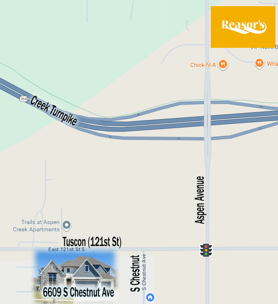
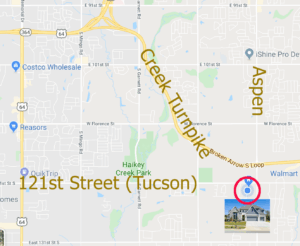
Take the Creek Turnpike to the Aspen Avenue Exit. Turn SOUTH onto Aspen Avenue.
At the light, turn RIGHT (WEST) onto Tucson/121st Street.
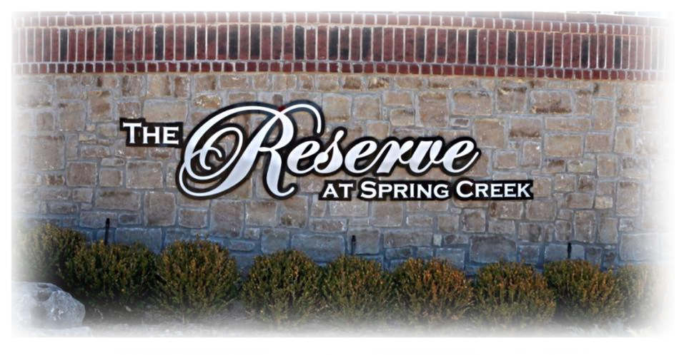
Turn LEFT (SOUTH) in 0.2 miles onto Chestnut Avenue–the first street on the left. The name of the subdivision is the Reserve at Spring Creek.
Our home, 6609 S. Chestnut, is about 0.1 mile on your left.
Look for the sign marking the entrance to the subdivision at 121st Street and Chestnut.
Alternate routes that avoid the Turnpike.
 From Midtown.
Note: Construction at 121st and Mingo is now complete, so this route to the President’s home is now clear.
The simplest route from Midtown is to get on Riverside heading south and stay on it. South of the Creek Turnpike, it makes a long, gentle curve to the left and eventually becomes eastbound South 121st Street (Tuscson Avenue in Broken Arrow). You can follow this all the way to our subdivision, a little over six miles after the street becomes east-bound. From Memorial Avenue, it’s 3.9 miles to Chestnut Avenue and our subdivision, the Reserve at Spring Creek. Turn south on Chestnut, and our home is on the left after about 0.1 miles.
Many north-south Tulsa streets also connect through to 121st Street, and so there are variations of this route depending on where you connect with 121st Street. Yale, Sheridan, and other streets further east all continue to 121st Street. Note that Harvard and Lewis dead-end and do NOT connect to 121st, while Riverside actually becomes 121st Street.
Many east-west Tulsa streets connect to Aspen Avenue (145th East Avenue in Tulsa) and provide additional alternatives. Note that 111th Street South does NOT go all the way to Riverside in Tulsa and dead-ends west of Yale Avenue.
From the north via 169.
Get off 169 at 91st Street. Go east about 2.5 miles to Aspen/145th Avenue and turn RIGHT (SOUTH). Continue south on Aspen 3 miles to 121st/Tucson Avenue. Turn RIGHT (WEST) on Tucson, then in 0.2 miles turn left onto Chestnut Avenue. Our home is about 0.1 mile on the left.
From Keifer/Glenpool
Take 67 east to US 64 (Memorial Avenue) in Bixby. Turn LEFT (NORTH) on Memorial and proceed north 3 miles. Turn RIGHT (EAST) on 121st Street/Tucson. Continue 3.9 miles to our subdivision, the Reserve at Spring Creek. At the subdivision, turn right onto Chestnut Avenue. Our home is about 0.1 miles on the left.
Street Names in Broken Arrow.
Broken Arrow and Tulsa are now adjacent to each other, but this wasn’t always the case. Because of this, their street names are different. To help with way-finding, Broken Arrow has given most major streets two names. One is the traditional BA name, and the other is the corresponding Tulsa name. Most–but not all–street signs in Broken Arrow show both names. For the purpose of these directions, here are the dual names you need to know:
Tucson Street in BA is also 121st Street South.
Aspen Avenue in BA is also East 145th Avenue.
Be First to Comment